Across Latin America, rural territories are facing increasingly complex and interconnected challenges. Climate variability is intensifying. Water stress is reshaping agricultural systems. Landslides and wildfires are threatening productive landscapes. Deforestation and soil degradation are progressing quietly but persistently. While these pressures manifest differently in each country, they share a common need: better information to anticipate risks, support decision-making, and strengthen territorial resilience.
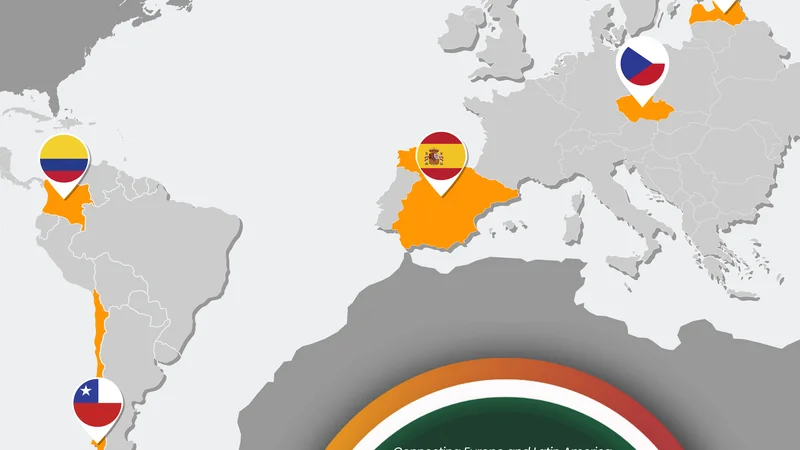
The COMUNIDAD Project was designed precisely for this purpose. By integrating Copernicus satellite Earth observation, EGNSS precise positioning, and advanced territorial analysis models, the COMUNIDAD Platform transforms complex geospatial data into accessible, actionable insights for local stakeholders. Through this regional focus, we examine how these digital tools can be tailored to diverse territorial contexts across Brazil, Peru, Argentina, Mexico, Nicaragua, and Ecuador.
In Brazil, particularly in Minas Gerais, agricultural productivity coexists with mounting environmental pressure. Seasonal wildfires in the Cerrado and transition zones are intensifying under prolonged droughts and heatwaves. At the same time, landslides in mountainous coffee-growing regions threaten rural infrastructure, agricultural logistics, and family livelihoods. These risks are not isolated events; they are symptoms of deeper territorial vulnerabilities linked to climate variability, land-use change, and environmental stress. The COMUNIDAD Platform could support early identification of wildfire-prone areas through vegetation, soil moisture, and temperature indicators, while also enabling landslide susceptibility mapping based on slope, rainfall, land cover, and historical patterns. Integrated dashboards could provide cooperatives, civil protection authorities, and environmental institutions with clearer territorial intelligence to support preventive planning and rapid response.
Peru faces similarly interconnected challenges, particularly in its Andean and peri-Andean regions. Frequent landslides triggered by steep slopes, intense rainfall, and soil degradation affect rural communities and critical infrastructure. At the same time, high-Andean river basins are experiencing increasing water stress due to glacier retreat, altered precipitation patterns, and growing pressure on water resources. Agriculture, rural livelihoods, and territorial planning are all influenced by these hydrological shifts. The COMUNIDAD Platform could contribute by generating machine-learning–based landslide susceptibility maps and integrating precipitation, soil moisture, vegetation dynamics, and seasonal basin behaviour to support water-stress analysis. By combining satellite observation with territorial modelling, local and regional authorities could gain clearer insight into vulnerable zones and emerging risks.
In Argentina, climate extremes have placed water management at the centre of territorial sustainability. In recent years, severe drought has directly affected agricultural and livestock production, particularly in regions dependent on major river basins. Beyond immediate impacts, a more gradual process is unfolding: soil degradation. Driven by recurrent droughts, climate variability, and intensive land-use practices, soil quality in some regions is progressively declining. Unlike sudden disasters, soil degradation advances silently, weakening long-term productivity and resilience. The COMUNIDAD Platform could support territorial water-stress mapping through the integration of precipitation data, vegetation indices, and soil-moisture–derived indicators, while also helping to identify early signals of soil degradation through land-cover change and vegetation dynamics. Such tools would not replace existing governance systems but would complement them with spatially explicit, reusable information for planning at regional scale.
Mexico is confronting two structural pressures that are deeply interconnected: progressive land-cover degradation and increasing water stress under high climate variability. In many agricultural–forest mosaics, distinguishing between legitimate productive cycles and permanent forest loss remains technically challenging. Traditional monitoring approaches may generate false positives, complicating environmental planning and policy implementation. Simultaneously, recurrent droughts and uneven water distribution are placing growing pressure on agricultural production and rural livelihoods. The COMUNIDAD Platform could support multitemporal land-cover monitoring, helping to differentiate structural vegetation loss from temporary productive transformations. By integrating precipitation patterns, soil moisture proxies, vegetation indicators, and land-use information, it could also contribute to clearer assessments of territorial water stress, supporting more preventive and balanced planning between conservation and development.
In Nicaragua, mountainous productive regions in the north and centre of the country face recurrent landslides linked to steep terrain, intense rainfall, and hillside agriculture. These events affect rural families, disrupt infrastructure, and generate significant economic losses. At the same time, progressive forest-cover loss in areas under expanding agricultural and livestock activity presents long-term environmental challenges. The COMUNIDAD Platform could integrate topography, precipitation, land cover, and historical event data to generate probabilistic landslide susceptibility maps, while also supporting deforestation detection adapted to productive systems. By reducing false positives and improving territorial monitoring, such tools could strengthen preventive planning and environmental governance without duplicating formal monitoring systems.
Ecuador presents another context where complex landscapes require nuanced monitoring approaches. In Andean and Amazonian regions, land-use change is reshaping forest–agriculture mosaics under growing productive pressure. Detecting structural vegetation loss in these environments is complicated by topography, climate variability, and frequent cloud cover. Additionally, Andean territories remain highly exposed to landslides driven by steep slopes and intense rainfall. The COMUNIDAD Platform could integrate optical and radar satellite data for more robust land-cover classification while applying validated deforestation-detection and landslide-susceptibility methodologies adapted to complex productive landscapes. This combination of multitemporal analysis and territorial modelling could support more informed land-use planning and preventive risk management.
Across these six countries, the specific challenges differ in detail, yet a common pattern emerges. Climate variability is intensifying. Environmental pressures are accumulating. Agricultural systems are becoming more vulnerable. What connects these realities is the need for integrated, accessible territorial intelligence.
The COMUNIDAD Platform complements national systems and local expertise by transforming satellite Earth observation and geospatial analysis into practical tools tailored to real territorial challenges. Experiences validated in Chile and Colombia demonstrate that these methodologies are scalable, and adaptable to diverse contexts. By connecting satellite data to local decision-making, COMUNIDAD offers a pathway toward more preventive, informed, and resilient territorial governance across Latin America.
Existing Comments