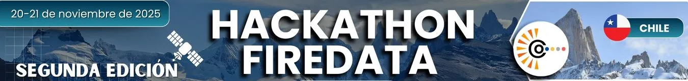
Hackathon Chile

Haz clic aquí para ver la versión en español
The second edition of the Geospatial Hackathon for Chilean Patagonia is here!
The event includes mentoring sessions and feedback from experts in AI, satellite mapping, and geospatial analysis. Participants will work in teams to design and present prototypes to an international panel of judges.
FireData Copernicus Patagonia
The second Patagonia Hackathon invites participants to take part in the FireData Copernicus Patagonia challenge, aimed at developing technological solutions to prevent, monitor, and assess forest fires in the Patagonian ecosystems of the Aysén Region. This 24-hour virtual challenge aims to leverage the information generated by the Copernicus satellite program, integrating it with geospatial technologies, data analysis, geoprocessing, and artificial intelligence, with the goal of improving the understanding and monitoring of these events in their different stages.
In this context, satellite observation offers key tools for addressing phenomena such as the emergence of active fires, the identification of hot spots, abrupt changes in the Earth's surface, and thermal or spectral signals associated with fire activity. These observations provide an approximation of the location, extent, and intensity of forest fires, as well as the immediate effects they have on the landscape and vegetation.
The teams will be able to develop prototypes aimed at different areas of the fire cycle, such as:
- Risk or susceptibility assessment
- Detection and monitoring of active fires
- Post-fire assessment, including estimates of damage severity and its impact on Patagonian ecosystems
The challenge seeks to promote innovative solutions that contribute to strengthening regional capacities for fire management, from early warning to ecological recovery, with the support of the COMUNIDAD project.
COMUNIDAD Security Challenge
The COMUNIDAD Security Challenge is designed to evaluate the resilience, protection, and performance of the COMUNIDAD platform in controlled cybersecurity scenarios. This challenge offers participants a secure environment to identify vulnerabilities and propose improvements that strengthen the project's technological infrastructure.
The challenge will take place on a dedicated clone of the COMUNIDAD pre-production infrastructure, recently validated for testing (testing environment). This space allows realistic attack scenarios to be simulated without affecting production systems.
In this context, the challenge invites exploration of aspects such as authentication mechanisms, data security, system integrity, and encryption protocols, contributing to improving the secure-by-design approach of future versions of the platform.
Main Objective
Assess the security posture of the COMMUNITY platform by identifying vulnerabilities, analyzing protection mechanisms, and proposing improvements that increase the resilience, integrity, and security of the system.
Specific Goals
- Identify vulnerabilities within the cloned environment by reviewing data flows, storage, transmission, and information protection.
- Evaluate authentication mechanisms (password validation, MFA, session management) and their robustness against misuse.
- Analyze the system's behavior when faced with attempts to exploit design or configuration flaws.
- Review security and encryption protocols, verifying compliance with best practices.
- Document findings and recommendations that contribute to the project's secure development strategies.
Event Format
- Date: November 28–29, 2025
- Format: Virtual, intensive 24-hour hackathon
- Main Language: Spanish
Registration
Deadline: November 27 at 1:00 p.m.
To register:
- Complete the online form (HERE)
- Submit a 500-word solution summary
- Include team and member details (names, contact, expertise)
- Teams must consist of a minimum of 2 and a maximum of 3 members
- Registration must be done by a team representative.
Mentors & Jury
Participants will receive ongoing guidance from a network of experts representing the COMUNIDAD Project and other partner institutions.
Mentors are specialists in:
- Applied AI and machine learning
- Satellite data processing and remote sensing
- Geospatial analysis and data visualisation
The hackathon mentors include experts from Chile and the COMUNIDAD Project team, who will provide personalised technical and thematic support during the event.
The Jury:
The final projects will be evaluated by a panel of experts from UAysén and FIA, who will analyse the innovation, technical quality, and impact of each project.
Areas of expertise: AI applications in land use, forestry and agricultural systems, satellite imagery, geospatial modelling, and digital solutions for sustainability.
Infrastructure
Participants will have access to the digital resources and infrastructure of the COMUNIDAD Project, including:
- Servers and computing platforms – (https://comunidad-project.eu/platform/)
- Pre-processed satellite datasets – (https://comunidad-project.eu/eo/stac/, API key: eo-api-key-dev)
- Repository with notebooks, APIs, and tutorials – (https://comunidad-project.eu/jupyter/hub/)
These resources will support data processing, model development, and visualisation throughout the hackathon.
Evaluation Criteria
| Criterion | Description | Points |
|---|---|---|
| Impact and Relevance of the Problem | Assess understanding of the challenge and the potential of the solution to generate a positive and sustainable impact in the Aysén Region. | 15 |
| Innovation and Originality | Measures creativity and novelty of approach. It assesses whether the solution proposes an unconventional use of data, technologies, or a new perspective to solve the problem. | 15 |
| Technical Implementation and Use of Geospatial Data | Consider the quality of the prototype (MVP), the robustness of the methodology used, and the effective use of geospatial tools and data, including sources such as Copernicus and/or local data. The ability to process, analyse, and visualise this data in a manner consistent with the problem posed is also valued. | 30 |
| Design and User Experience (UX) | Evaluate whether the prototype is intuitive, easy to use, and whether its design (even if basic) allows for clear and effective interaction for the user experience. | 15 |
| Presentation | The ability to effectively communicate the problem, solution, and impact in a 10-15 minute presentation is evaluated. | 15 |
| Collaboration and Project Management | Evaluate team dynamics. Look for evidence of collaborative work, effective role distribution, and good time management during the hackathon. | 10 |
Awards
- 1st Place: Participation in the COMUNIDAD Final Conference in Belo Horizonte, Brazil, including travel expenses up to a maximum of €2,500 for the winning team. *Conditions and restrictions apply based on budget availability. Winning participants are individually responsible for complying with the respective immigration requirements.
- Outstanding projects may be integrated into the COMUNIDAD Platform, with full credit and potential for future collaboration.
Ethics & Code of Conduct
The hackathon aims to foster an inclusive, collaborative, and respectful environment for all participants. All attendees—including participants, organisers, mentors, and judges—must adhere to the following code of conduct:
Respect and Diversity
- All individuals should be treated with respect, regardless of gender, identity, sexual orientation, nationality, disability, age, religion, or level of experience.
- Acts of discrimination, harassment, intimidation, or offensive behaviour of any kind will not be tolerated.
Teamwork and Collaboration
- A spirit of cooperation and mutual learning is encouraged.
- Teamwork must be fair, recognising and valuing the contributions of all members.
- Competition must remain healthy, avoiding dishonest or unfair practices.
Ethical Use of Technology
- Solutions must comply with legal regulations and ethical principles, avoiding the misuse of data or the development of tools with harmful applications.
- Transparency in the use of data sources and software must be guaranteed, including respect for licenses and corresponding attribution.
Integrity and Intellectual Property
- Teams retain intellectual property rights over their developments.
- The authorship of third-party work and any external material used must be respected.
- Plagiarism and misappropriation of others' ideas are strictly prohibited.
Responsible Use of Resources
- Participants are expected to use the technological tools, platforms, and spaces provided by the hackathon in an appropriate and responsible manner.
- Malicious techniques such as cyberattacks or data manipulation will not be tolerated.
Behaviour During Presentations and Evaluations
- Presentations must be timely, clear, and respect the assigned time limits.
- Feedback and evaluations should be received with a constructive and professional attitude.
Consequences of Non-Compliance
- Any violation of the code of conduct may result in warnings, team disqualification, or, in serious cases, expulsion from the event.
- The organisers reserve the right to take the necessary measures to ensure a safe and respectful environment.
You can find detailed information about our privacy policy here.
Communication Channels
- Contact: comunidad.patagoniachilena@gmail.com
- Website: COMUNIDAD Project
- Hackathon Channel: Discord
Hackathon Structure and Schedule (24 hours)
Friday, November 28:
| Schedule | Activity | Description |
|---|---|---|
| 9:00–11:00 | Opening and initial workshop | Welcome, presentation of the challenge and the COMMUNITY ecosystem. |
| 11:00-13:00 | Hacking block 1 | Freelance work for activities related to prototype development. |
| 14:00–16:00 | Mentoring and questions section | Technical and thematic consulting (AI, satellite data, geospatial mapping, visualisation). |
| Post–16:00 hrs | Hacking block 2 | Freelance work for activities related to prototype development. |
Saturday, November 29:
| Schedule | Activity | Description |
|---|---|---|
| 09:00–11:00 | Mentoring and questions section | Technical and thematic consulting (AI, satellite data, geospatial mapping, visualisation). |
| 11:00–14:00 | Final hacking block | Independent work on activities related to prototype development. In addition, teams must prepare the final presentation and repositories. |
| 14:00–18:00 | Jury deliberation and selection of winners. | Present the prototypes in 10–15 minutes to the jury, who will deliberate and choose the winning team, bringing the second edition of Hackathon Patagonia to a close. |
Present the prototypes in 10–15 minutes to the jury, who will deliberate and choose the winning team, bringing the second edition of Hackathon Patagonia to a close.
Join us in promoting innovative solutions that contribute to understanding, preventing, and assessing forest fires in Patagonia!
Haz clic aquí para ver la versión en inglés
¡Llega la segunda edición de la Hackathon Geoespacial para la Patagonia Chilena!
El evento incluye sesiones de mentoría y retroalimentación de expertos en IA, cartografía satelital y análisis geoespacial. Los participantes trabajarán en equipos para diseñar y presentar prototipos ante un panel internacional de jurados.
FireData Copernicus Patagonia
La segunda Hackathon Patagonia invita a participar en el desafío FireData Copernicus Patagonia, orientado a desarrollar soluciones tecnológicas para prevenir, monitorear y evaluar incendios forestales en los ecosistemas patagónicos de la Región de Aysén. Este desafío virtual de 24 horas propone aprovechar la información generada por el programa de satélites Copernicus, integrándose con tecnologías geoespaciales, análisis de datos, geoprocesamiento e inteligencia artificial, con el propósito de mejorar la comprensión y el seguimiento de estos eventos en sus distintas etapas.
En este contexto, la observación satelital ofrece herramientas clave para abordar fenómenos como la aparición de incendios activos, la identificación de puntos calientes, los cambios abruptos en la superficie terrestre y las señales térmicas o espectrales asociadas a la actividad del fuego. Estas observaciones permiten aproximarse a la ubicación, extensión e intensidad de los incendios forestales, así como a los efectos inmediatos que estos generan sobre el paisaje y la vegetación.
Los equipos podrán desarrollar prototipos orientados a distintos ámbitos del ciclo del fuego, tales como:
- Estimación del riesgo o susceptibilidad,
- Detección y seguimiento de incendios activos,
- Evaluación posterior al incendio, incluyendo aproximaciones a la severidad del daño y su impacto sobre los ecosistemas patagónicos.
El desafío busca fomentar soluciones innovadoras que contribuyan a fortalecer las capacidades regionales para la gestión del fuego, desde la alerta temprana hasta la recuperación ecológica, con el respaldo del proyecto COMUNIDAD.
COMUNIDAD Security Challenge
El desafío COMUNIDAD Security Challenge, está orientado a evaluar la resiliencia, protección y comportamiento de la plataforma COMUNIDAD frente a escenarios controlados de ciberseguridad. Este desafío ofrece a los participantes un entorno seguro para identificar vulnerabilidades y proponer mejoras que fortalezcan la infraestructura tecnológica del proyecto.
El reto se desarrollará sobre un clon dedicado de la infraestructura pre-producción de COMUNIDAD, recientemente validado para pruebas (testing environment). Este espacio permite simular situaciones realistas de ataque sin afectar los sistemas productivos.
En este contexto, el desafío invita a explorar aspectos como mecanismos de autenticación, seguridad de datos, integridad de los sistemas y protocolos de cifrado, contribuyendo a mejorar el diseño seguro (“secure-by-design”) de futuras versiones de la plataforma.
Objetivo Principal
Evaluar la postura de seguridad de la plataforma COMUNIDAD a través de la identificación de vulnerabilidades, análisis de mecanismos de protección y propuesta de mejoras que aumenten la resiliencia, integridad y seguridad del sistema.
Objetivos Específicos
- Identificar vulnerabilidades dentro del entorno clonado mediante la revisión de flujos de datos, almacenamiento, transmisión y protección de la información.
- Evaluar mecanismos de autenticación (validación de contraseñas, MFA, manejo de sesiones) y su robustez ante usos indebidos.
- Analizar el comportamiento del sistema ante intentos de explotación de fallas de diseño o configuración.
- Revisar protocolos de seguridad y cifrado, verificando el cumplimiento de buenas prácticas.
Documentar descubrimientos y recomendaciones que contribuyan a las estrategias de desarrollo seguro del proyecto.
Formato del Evento
- Fecha: 28–29 de noviembre de 2025
- Modalidad: Virtual, hackathon intensiva de 24 horas
- Idioma principal: Español
Registro
Fecha límite: 27 de noviembre a las 13:00 hrs
Para inscribirse:
- Complete el formulario en línea (AQUÍ)
- Envíe un resumen de la solución (máximo 500 palabras)
- Incluya los datos del equipo y sus miembros (nombres, contacto, área de especialización)
- Equipos conformados por un mínimo de 2 y máximo de 3 integrantes
- El registro debe hacerse por un representante del equipo.
Mentores y Jurado
Los participantes recibirán orientación continua de una red de expertos que representan el Proyecto COMUNIDAD y otras instituciones asociadas.
Los mentores son especialistas en:
- IA aplicada y aprendizaje automático
- Procesamiento de datos satelitales y teledetección
- Análisis geoespacial y visualización de datos
Los mentores del hackathon incluyen expertos de Chile y del equipo del Proyecto COMUNIDAD, quienes brindarán apoyo técnico y temático personalizado durante el evento.
El jurado:
Los proyectos finales serán evaluados por un panel de expertos de la UAysén y FIA, quienes analizarán la innovación, la calidad técnica y el impacto de cada proyecto.
Áreas de experiencia: aplicaciones de IA en usos de suelo, sistemas silvoagropecuarios, imágenes satelitales, modelado geoespacial y soluciones digitales para la sostenibilidad.
Infraestructura
Los participantes tendrán acceso a los recursos digitales e infraestructura del Proyecto COMUNIDAD, que incluyen:
- Servidores y plataformas informáticas – (https://comunidad-project.eu/platform/)
- Conjuntos de datos satelitales preprocesados – (https://comunidad-project.eu/eo/stac/, API key: eo-api-key-dev)
- Repositorio con notebooks, APIs y tutoriales – (https://comunidad-project.eu/jupyter/hub/)
Estos recursos respaldarán el procesamiento de datos, el desarrollo de modelos y la visualización durante todo el hackathon.
Criterios de Evaluación
| Criterio | Descripción | Puntos |
|---|---|---|
| Impacto y Relevancia del Problema | Evalúa la comprensión del desafío y el potencial de la solución para generar un impacto positivo y sostenible en la Región de Aysén. | 15 |
| Innovación y Originalidad | Mide la creatividad y la novedad del enfoque. Se valora si la solución propone un uso no convencional de los datos, tecnologías o una perspectiva nueva para resolver el problema. | 15 |
| Ejecución Técnica y Uso de Datos Geoespaciales | Considera la calidad del prototipo (MVP), la solidez de la metodología empleada y el uso efectivo de herramientas y datos geoespaciales, incluyendo fuentes como Copernicus y/o datos locales. También se valora la capacidad de procesar, analizar y visualizar estos datos de manera coherente con el problema planteado. | 30 |
| Diseño y Experiencia de Usuario (UX) | Evalúa si el prototipo es intuitivo, fácil de usar y si su diseño (aunque sea básico) permite una interacción clara y efectiva para la experiencia de usuario. | 15 |
| Presentación | Se califica la capacidad de comunicar el problema, la solución y el impacto de forma efectiva en una presentación de 10-15 minutos. | 15 |
| Colaboración y Gestión del Proyecto | Evalúa la dinámica del equipo. Se busca evidencia de un trabajo colaborativo, una distribución de roles efectiva y una buena gestión del tiempo durante el hackathon | 10 |
Premios
- Primer lugar: Participación en la Conferencia Final de COMUNIDAD en Bello Horizonte - Brasil, incluyendo financiamiento de gastos de viaje hasta un máximo de 2500 € para el equipo ganador. *Se aplican condiciones y restricciones por disponibilidad presupuestaria, los participantes ganadores son responsables de cumplir de manera individual con las condiciones migratorias respectivas.
- Los proyectos destacados podrán integrarse en la Plataforma COMUNIDAD, con pleno reconocimiento a sus autores y posibilidad de colaboración futura.
Ética y Código de Conducta
El hackathon tiene como objetivo fomentar un ambiente inclusivo, colaborativo y respetuoso para todas las personas participantes. Todos los asistentes —incluyendo participantes, organizadores, mentores y jurado— deben adherirse al siguiente código de conducta:
Respeto y Diversidad
● Todas las personas deben ser tratadas con respeto, independientemente de su género, identidad, orientación sexual, nacionalidad, discapacidad, edad, religión o nivel de experiencia.
● No se tolerarán actos de discriminación, acoso, intimidación o comportamiento ofensivo de ningún tipo.
Trabajo en Equipo y Colaboración
● Se fomenta un espíritu de cooperación y aprendizaje mutuo.
● El trabajo en equipo debe ser justo, reconociendo y valorando las contribuciones de todas las personas integrantes.
● La competencia debe mantenerse sana, evitando prácticas deshonestas o injustas.
Uso Ético de la Tecnología
● Las soluciones deben cumplir con las normativas legales y principios éticos, evitando el uso indebido de datos o el desarrollo de herramientas con aplicaciones perjudiciales.
● Se debe garantizar la transparencia en el uso de fuentes de datos y software, incluyendo el respeto a las licencias y la atribución correspondiente.
Integridad y Propiedad Intelectual
● Los equipos conservan los derechos de propiedad intelectual sobre sus desarrollos.
● Se debe respetar la autoría de los trabajos de terceros y de cualquier material externo utilizado.
● Está estrictamente prohibido el plagio y la apropiación indebida de ideas ajenas.
Uso Responsable de los Recursos
● Se espera que las personas participantes utilicen de manera adecuada y responsable las herramientas tecnológicas, plataformas y espacios proporcionados por el hackathon.
● No se tolerarán técnicas maliciosas como ciberataques o manipulación de datos.
Comportamiento Durante las Presentaciones y Evaluaciones
● Las presentaciones deben ser puntuales, claras y respetar los límites de tiempo asignados.
● La retroalimentación y las evaluaciones deben recibirse con una actitud constructiva y profesional.
Consecuencias del Incumplimiento
● Cualquier violación al código de conducta puede resultar en advertencias, descalificación del equipo o, en casos graves, expulsión del evento.
● Los organizadores se reservan el derecho de tomar las medidas necesarias para garantizar un entorno seguro y respetuoso.
Puedes encontrar información detallada sobre nuestra política de privacidad aquí.
Canales de Comunicación
● Contacto: comunidad.patagoniachilena@gmail.com
● Sitio web: Proyecto COMUNIDAD
● Canal del hackathon: Discord
Estructura y Cronograma de la Hackathon (24 horas)
Viernes 28 de noviembre:
| Horario | Actividad | Descripción |
|---|---|---|
| 9:00–11:00 | Apertura y taller inicial | Bienvenida, presentación del reto y del ecosistema COMUNIDAD. |
| 11:00-13:00 | Bloque de hacking 1 | Trabajo autónomo para actividades relacionadas al desarrollo del prototipo. |
| 14:00–16:00 | Franja de Mentorías y preguntas | Asesorías técnicas y temáticas (IA, datos satelitales, mapeo geoespacial, visualización). |
| Post–16:00 hrs | Bloque de hacking 2 | Trabajo autónomo para actividades relacionadas al desarrollo del prototipo |
Sábado 29 de noviembre:
| Horario | Actividad | Descripción |
|---|---|---|
| 09:00–11:00 | Franja de Mentorías y preguntas | Asesorías técnicas y temáticas (IA, datos satelitales, mapeo geoespacial, visualización). |
| 11:00–14:00 | Bloque final hacking | Trabajo autónomo para actividades relacionadas al desarrollo del prototipo. Además, los equipos deberán preparar la presentación final y repositorios. |
| 14:00–18:00 | Deliberación del jurado y selección de ganadores. | Presentar los prototipos en 10–15 minutos ante el jurado, quien deliberará y elegirá al equipo ganador, dando cierre a la segunda versión del Hackathon Patagonia. |
¡Únete a nosotros para impulsar soluciones innovadoras que contribuyan a comprender, prevenir y evaluar los incendios forestales en la Patagonia!

Haz clic aquí para ver la versión en español.
Note: The information below refers to the first edition of the COMUNIDAD Hackathon, which took place between May and June 2025. The upcoming event (Phase 2) builds on the experiences and outcomes of this first COMUNIDAD Hackathon edition.
COMUNIDAD Hackathon: First Geospatial Hackathon for Chilean Patagonia
Welcome to the COMUNIDAD Hackathon in Chile! This exciting event is tailored to turning Satellite Data into Action for Climate Resilience and Sustainable Land Management in Chilean Patagonia.
About the Hackathon
The COMUNIDAD Hackathon: First Geospatial Hackathon in Chilean Patagonia is part of the COMUNIDAD project's mission to foster innovation and technological capacity across Latin America. This event invites students, researchers, professionals, and innovators to co-create digital tools using Copernicus satellite data, climate records, and local datasets to address the urgent environmental challenges of Chile’s southern regions.
Hosted by the Universidad de Aysén in collaboration with the Agricultural Innovation Agency (FIA) and a strong network of regional partners, the Hackathon focuses on advancing climate adaptation, glacier and lake monitoring, and sustainable forestry, livestock and agriculture through the use of AI, geospatial tools, and remote sensing technologies.
Participants will access and analyze open-source data from:
- Sentinel-1: Radar imagery for land deformation and flood detection
- Sentinel-2: Optical imagery for monitoring vegetation and land cover
- Sentinel-3: Surface temperature, fire detection, and water quality analysis
- Sentinel-5P: Atmospheric pollution and emissions tracking
Complemented by regional data and supported by the Copernicus Climate Change Service (C3S), participants will apply these tools to build solutions tailored to the needs of Patagonia’s ecosystems and communities.
Objectives
- Apply satellite data and AI to strengthen environmental monitoring in Patagonia.
- Design digital tools for climate adaptation and sustainable resource use.
- Promote collaboration between research institutions, public agencies, and civil society.
- Empower local decision-making through open-access geospatial solutions.
Hackathon Format
Phase 1: Development Sprint (Hybrid)
Duration: May 20 – June 17, 2025
Teams will engage in a hybrid development phase where they receive mentoring, attend guest speaker sessions (Chilean and European), and work collaboratively to design and prototype their geospatial solutions. Mentors from institutions such as CIEP, INIA, CORFO, FIA, and IDE Chile will provide expert guidance.
Phase 2: Final Workshop & Awards (Hybrid)
Date: June 25, 2025
The finalist teams will present their work to a jury of national and international experts. The solutions will be evaluated based on their level of innovation, use of data, environmental and social relevance, and clarity of communication.
Who Can Participate?
We welcome:
- Students, researchers, professionals, and entrepreneurs (18+)
- Individuals and teams (3–5 members recommended)
- Backgrounds in Earth observation, geosciences, remote sensing, AI, or natural resources
- No programming experience is required; multidisciplinary collaboration is encouraged
- Participants from across Latin America and the Caribbean

Challenges
1.IceEnd-Hack
Monitoring Glaciers and Lakes for Risk Management and Climate Resilience
Develop geospatial tools to monitor glacier height and glacial lake volume changes. Use multi-temporal satellite imagery and climate data to support early warning systems and disaster risk reduction in local communities.
More information about this challenge can be found HERE.
2. Hackea tu terruño
Multi-Source Data Integration for Sustainable Silvoagropecuary Management
Create a solution that integrates satellite imagery, UAV data, and climate records to optimize land use planning and natural resource management in silvoagropecuary systems.
More information about this challenge can be found HERE.
Timeline
| PHASE | ACTIVITY | DATES |
|---|---|---|
| Registration & Team Formation | Receiving registration applications | May 05 – May 23 |
| Registration & Team Formation | Hackathon launch (hybrid) | May 12 |
| Registration & Team Formation | Announcing registration results (teams and mentors) | May 27 |
| Hacking | Kick-off, work sessions, mentoring, and talks | May 27 – June 19 |
| Hacking | Receive videos with development results | June 23 – June 24 |
| Closing | Selection of finalist groups (5 work teams) | June 26 |
| Closing | Final evaluation and awards | July 01 |
More detailed information about the timeline, including a breakdown of activities, can be found HERE.
Registration
Deadline: May 16, 2025
To register:
- Fill out the online form HERE.
- Provide team or participant details
- Select your preferred challenge
- Submit a motivation letter (max. 2,000 characters)
Optional: Include prior experience in geospatial tools or modelling
Wining Prize:
The winning teams of the hackathon will receive the following prizes as recognition for their work and the solutions developed during the event:
1st place: 5 laptops, one for each team member, plus a two-day stay at Airbnb Patagonia Nocturna
2nd place: Tablets for each team member
3rd place: Gaucho experience for 3 people

Meet the Team Supporting You!
Throughout the Hackathon, you’ll be supported by a team of dedicated professionals who will help you succeed from the moment you register to the final pitch presentation. Here’s who will be working alongside you:
Organizers: The Universidad de Aysén and FIA lead the event coordination. They’ll ensure you have what you need—clear guidance, schedules, and access to all platforms and tools. They’re your go-to team for any logistical or organizational questions.
Volunteers: This team keeps everything running smoothly behind the scenes. They’ll help manage the communication platforms, coordinate event sessions, and connect you with the right people when needed.
Jury: During the final event, a panel of professionals in innovation, technology, and environmental science will evaluate your project. They’ll review your work based on clear criteria and provide useful feedback that goes beyond the competition.
Technology Coordinator: Any technical issues? This person ensures that your tools, platforms, and data are fully functional. They’ll help with access, troubleshooting, and real-time problem-solving during the Hackathon.
Publicity & Website Team: Your work matters, and this team helps you share it. They’ll keep the website updated, promote your progress through social media, and spotlight innovative solutions coming from your team.
Mentors: Experts from institutions like CIEP, INIA, CORFO, and IDE-Chile will be available throughout the development phase. They’ll help you troubleshoot technical issues, offer strategic advice, and give feedback to strengthen your ideas and prototypes.
Mentors:
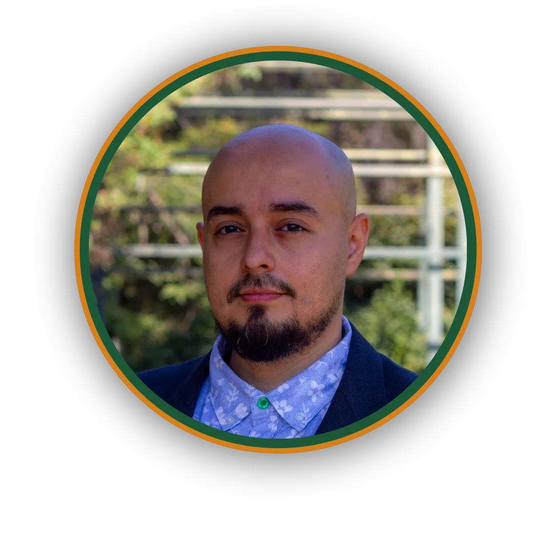
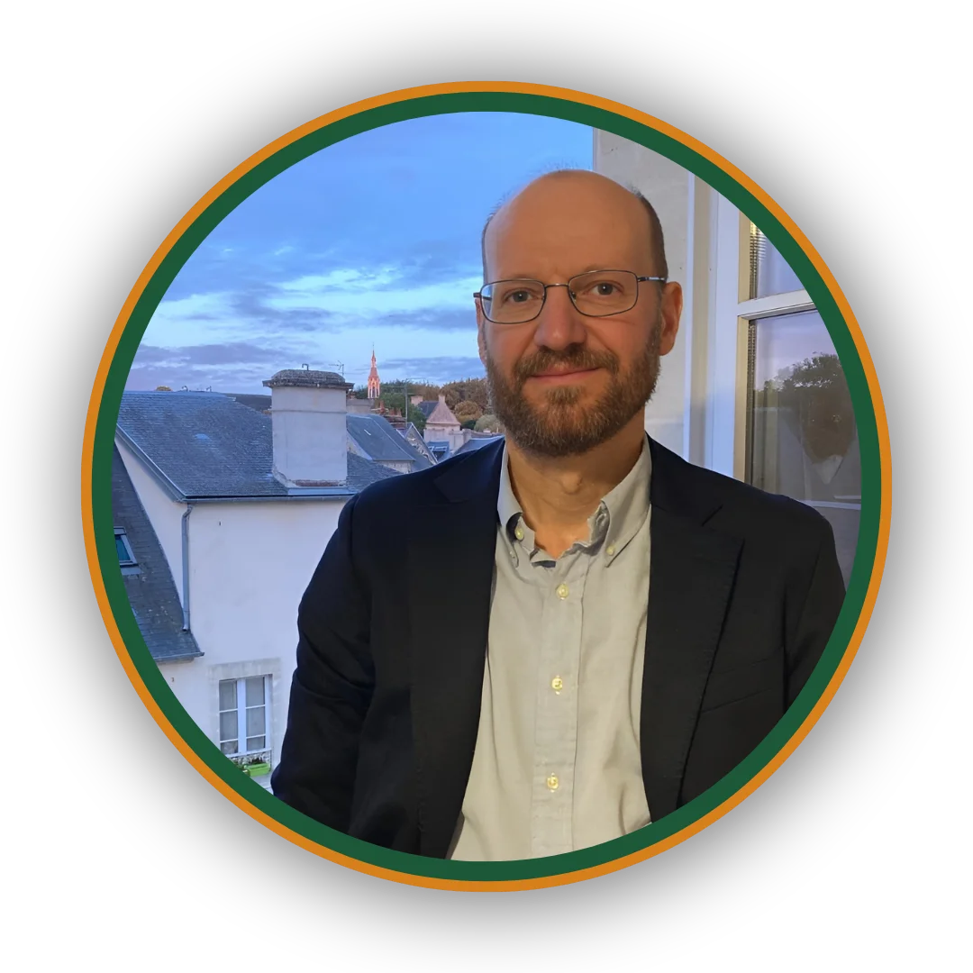
Juan José Gaete Acevedo
Specialist in Geographic Information Systems (GIS), CIEP – Centro de Investigación en Ecosistemas de la Patagonia
Juan José Gaete Acevedo is a geographer from the Pontificia Universidad Católica de Valparaíso, specializing in GIS, territorial analysis, and participatory methodologies. At CIEP, he serves as a GIS specialist, leading the development of the Geoportal Ciencia Austral and contributing to studies on just energy transition in the Aysén region. Since 2018, he has been involved in diverse projects on land-use planning, environmental governance, sustainable tourism, and climate change—frequently applying tools such as ArcGIS Online, Experience Builder, and Survey123. His work bridges spatial analysis with participatory approaches across topics such as national parks, artisanal fisheries, and local development plans. He also holds postgraduate diplomas in disaster risk reduction and climate change and was recognized as a distinguished alumni for his academic and professional achievements.
Areas of expertise: GIS, Territorial Analysis, Land-Use Planning and Development.
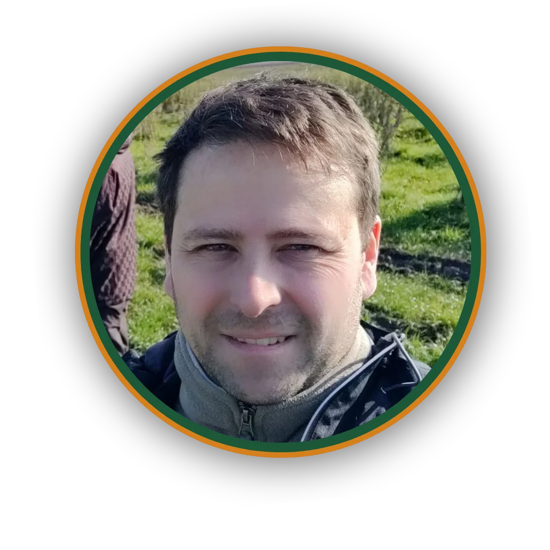
Diego Ocampo Melgar
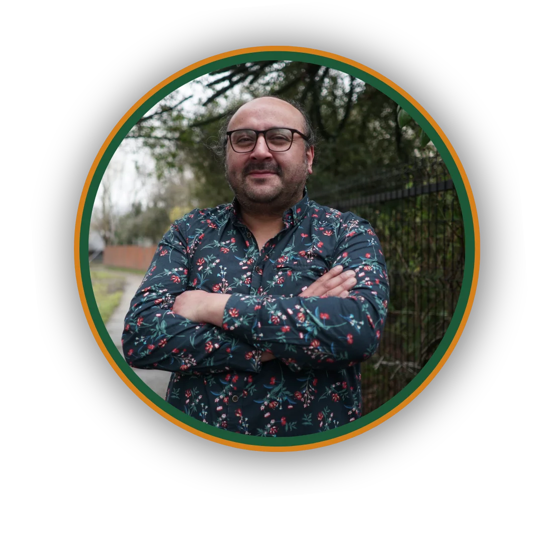
Geospatial Expert – Grüner SpA, Chile
Diego Ocampo Melgar is an environmental engineer and holds a master’s degree in natural resources, with over ten years of experience in Earth observation, geospatial modeling, and environmental intelligence. He is currently pursuing a PhD in Applied Biology and Ecology and works as a geospatial expert at Grüner SpA, where he develops AI algorithms for satellite data analysis. Between 2017 and 2024, he was a researcher at CSIRO Chile, contributing to international projects on conservation, climate change, and territorial management. He has led initiatives such as Data Cube Chile and has strong expertise in Python, R, SQL, and cloud platforms. His work integrates data science, remote sensing, and nature-based solutions to address complex environmental challenges.
Areas of expertise: Earth Observation and Remote Sensing, Geospatial Modeling, Environmental Intelligence, Data Science and AI, Natural Resource Management, Climate Change.
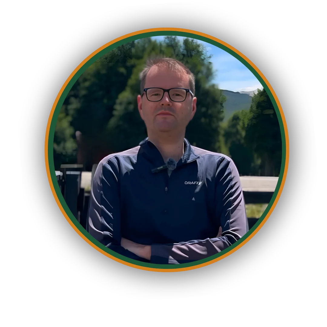
Marcelo Alejandro Sanhueza Ulloa
Head of Forestry Engineering Program – Universidad de Aysén
Marcelo Alejandro Sanhueza Ulloa is a forestry engineer from Universidad Austral de Chile with over fifteen years of experience in community-centered forest development. He currently serves as Adjunct Professor at Universidad de Aysén, where he has led the Forestry Engineering program and taught six courses since 2022. His professional background includes work in public institutions, private organisations, and scientific centers, with expertise in dendroenergy, non-timber forest products (NTFPs), community-based conservation, and the role of rural women. In 2016, he was awarded the Native Forest Prize (Premio Bosque Nativo) for his contributions to rural communities in the Aysén Region. He has advised social organisations such as the Patagonia Verde Agroforestry Union Federation and the Río Baker Cooperative, and led the implementation of REDLAC in Chile. His work focuses on improving rural quality of life through participatory and sustainable processes. He has also published on topics such as tourism in protected areas, aquatic fauna, NTFPs, and forest identity.
Areas of expertise: Native Forest Management, Non-Timber Forest Products (NTFPs), Rural Development, Territorial Approaches, GIS and Mapping.
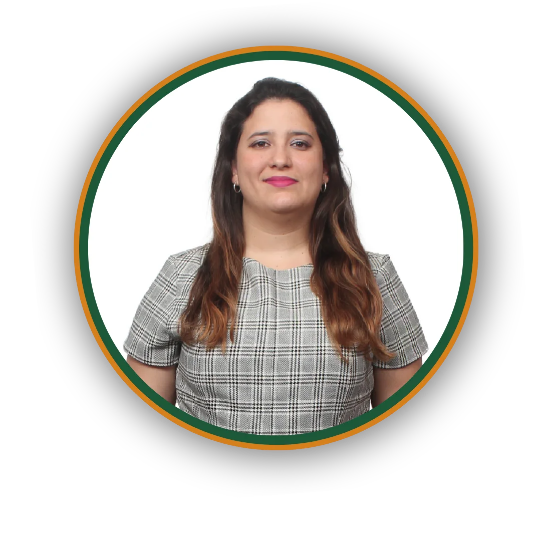
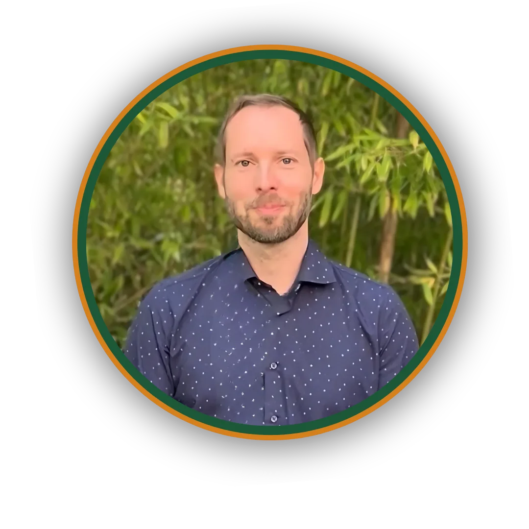
Karen Yobeily Escalona Escalona
Researcher – Universidad de Aysén (Chile), COMUNIDAD Project Remote Sensing and GIS Specialist – Instituto Forestal de Chile (INFOR)
Karen Escalona specialises in Geographic Information Systems (GIS), remote sensing, and satellite image analysis using big data and machine learning. Her work focuses on monitoring environmental variables such as water quality, vegetation, and land use. She holds a PhD in Physical Sciences from the Universidad de Concepción and a bachelor’s degree in Physics with a specialisation in Geophysics from the Universidad Central de Venezuela. She currently works as a researcher for the COMUNIDAD project (Horizon Europe) and as a remote sensing expert at the Instituto Forestal de Chile (INFOR), where she contributes to the Agroforestry Watershed Governance Project. She has also taught GIS and remote sensing at the Universidad del Bío-Bío and supervised undergraduate theses on environmental monitoring topics.
Areas of expertise: Remote Sensing and GIS, Environmental Satellite Data Analysis, Land Use and Vegetation Change Monitoring, Spatial Modelling and Decision-Support Tools
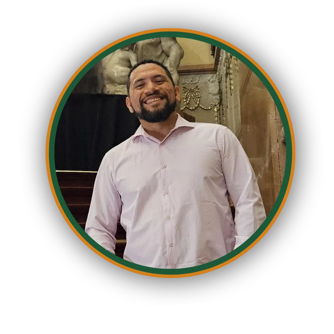
Juan Carlos Espinoza Reinoso
Director of Data Architecture and Machine Learning Municipality of Vicente López, Argentina / CAECE University
Juan Carlos Espinoza Reinoso is a physicist specialized in computational sciences, with extensive experience in data science, functional analysis, and strategic information management. As Director of Data Architecture and Machine Learning at the Municipality of Vicente López, he leads institutional modernization initiatives using artificial intelligence, distributed systems, and data flow automation. He has worked in both public and private sectors, including roles as a Functional Analyst for the Government of the City of Buenos Aires and a Data Miner at Banco Galicia. Since 2024, he has also taught web architecture and distributed systems at CAECE University. His work connects programming, numerical modelling, and applied computational analysis with innovation in public management.
Areas of expertise: Data Science, Distributed Systems, Web Architecture, Public Innovation, Automated Data Flows
Iván Rivero Sanz
Innovation and Financial Strategy Consultant RTDI / RTDI Innovation School
Iván Rivero Sanz has extensive experience in financial management, asset management, research and development consultancy, and new product development. He has designed financial and business plans for innovation-driven companies and played an active role in promoting and developing EU-funded R&D projects, particularly those focused on new products for international markets. Over the past decade, he has collaborated with RTDI and RTDI Innovation School, building tools and capabilities for accurate financial forecasting and compelling project presentations.
Areas of expertise: Financial Planning, EU R&D Project Development, Innovation Strategy, Business Models for Startups
Michal Kepka
Project manager and GIS specialist at the Baltic Open Solutions Center (BOSC)
He holds a Ph.D. in Geomatics and has been actively involved in national and European research and development projects since graduating in 2011. His work focuses on geographic information systems (GIS), spatial data analysis, and sensor data management. Michal applies GIS technologies in diverse fields, including agriculture, environmental protection, transport, and cultural heritage. He is part of the team behind SensLog, a specialised platform for managing sensor data. His expertise includes web mapping libraries, spatial databases, and integrating geospatial tools to support decision-making processes.
Areas of expertise: GIS, web mapping libraries, spatial databases, sensor data
Jiří Kvapil
Expert in cartography, geoinformatics, and remote sensing with over 20 years of experience in EU and international projects
He holds a Master's degree and has worked extensively on spatial data infrastructures (SDI), land cover monitoring, and water protection and management. At Lesprojekt, he is responsible for hardware and software infrastructure, data processing, web map publication, and project acquisition and coordination. Jiří has also contributed to environmental research and commercial projects focused on geospatial data analysis and remote sensing techniques. He previously served as head of the geoinformatics and remote sensing department at the Czech Environmental Information Agency and was the administrator of the National INSPIRE Geoportal in the Czech Republic.
Areas of expertise: Hardware planning, software deployment, web maps publication, data processing, remote sensing techniques
František Zadražil
Head of Software Development at the Baltic Open Solutions Center (BOSC),
where he leads initiatives in spatial data use for precision agriculture and citizen science. With a degree in Computer Graphics and Virtual Reality Engineering (2006), he possesses extensive experience in the GIS field. Over the years, he has worked with platforms such as MapServer, GeoServer, and ArcGIS, later advancing into team leadership and project management roles. František has contributed to the development and implementation of numerous GEO systems across both public and private sectors.
Areas of expertise: GIS architecture and analysis, Remote sensing
Adam Hruška
Researcher and PhD student at the Czech University of Life Sciences Prague (CZU)
with a strong background in machine learning, computer vision, and remote sensing. He holds two master’s degrees, one in International Security Studies from Charles University and another in Plant Production from CZU. His research focuses on applying artificial intelligence to enhance precision agriculture, particularly in the detection and management of weeds. He integrates advanced remote sensing technologies to optimise resource use in agricultural systems and supports environmental data monitoring and the implementation of sustainable technologies. Adam is also actively engaged in the use of large language models to process complex datasets and generate actionable insights across agricultural applications.
Areas of expertise: Machine learning, Computer vision, Remote sensing
Intellectual Property and licensing
- Ownership of Rights:
- Participants shall retain full ownership of the intellectual property rights to all ideas, concepts, source code, prototypes, products and any other original material they develop and document during the course of the hackathon (“Creations”). The hackathon organization will not claim any ownership rights to the Creations generated by the participants.
- Originality and Responsibility:
- Participants represent and warrant that their Creations are the result of their own original work and do not infringe intellectual property rights (such as patents, copyrights, trademarks) or any other rights (such as trade secrets or image rights) belonging to third parties. Each team is responsible for ensuring the originality of their work.
- Definition of License for Use by Authors:
- It will be the sole responsibility of the participants (as copyright holders) to define the terms under which their Creations may be used, distributed, modified or exploited by third parties. Participants may choose the type of license they wish to apply to their Creations, following common copyright and licensing standards and practices (e.g., opting for open source licenses such as MIT, Apache, GPL; Creative Commons licenses for content; or setting specific proprietary terms). It is recommended to clearly document the chosen license together with the project.
Use of the COMUNIDAD Platform
- Authorisation for use:
- The participants, according to the types of license they decide to apply for, may grant the organisers a non-exclusive, worldwide, and free license to integrate the solutions developed during the hackathon in the COMUNIDAD platform.
- Author Acknowledgement:
- The solutions implemented on the platform will credit the author teams as original creators, recognising their contributions to the project.
- Post-hackathon collaboration:
- Participants will have the opportunity to collaborate with the organisers to optimise and scale the solutions integrated in COMUNIDAD. These collaborations will be formalized through specific agreements respecting the rights of both parties.
Infringement of intellectual property
- Use of Pre-existing Materials:
- In case teams use pre-existing elements or materials in their projects (such as code libraries, software snippets, images, algorithms, datasets, etc.), they must ensure that they have the necessary authorizations or licenses for their use in the context of the hackathon and the project developed. Proper attribution to the sources of such pre-existing materials is mandatory, according to the terms of their respective licenses.
Data protection and advertising
Data protection:
- Personal data and materials provided during the hackathon will be processed in accordance with applicable legislation and will be used exclusively for purposes related to the event on official dissemination channels and the COMMUNITY website.
Publication of results:
- The organizers may publish the highlighted projects and their applications on the COMUNIDAD website, as dissemination material and always crediting the authors.
Code of Conduct
The hackathon aims to foster an inclusive, collaborative, and respectful environment for all participants. All attendees—including participants, organisers, mentors, and judges—are expected to adhere to the following code of conduct:
- Respect and Diversity
- All participants must be treated with respect, regardless of gender, identity, sexual orientation, nationality, disability, age, religion, or level of experience.
- Discrimination, harassment, intimidation, or offensive behaviour of any kind will not be tolerated.
- Teamwork and Collaboration
- A spirit of cooperation and mutual learning is encouraged.
- Teamwork should be fair, recognising and valuing the contributions of all members.
- Competition should remain healthy, avoiding unfair or dishonest practices.
- Ethical Use of Technology
- Solutions must comply with legal regulations and ethical principles, avoiding the misuse of data or the development of tools with harmful applications.
- Transparency in the use of data sources and software must be ensured, including proper licensing and attribution.
- Integrity and Intellectual Property
- Teams retain the intellectual property rights of their developments.
- Authorship of others’ work and any external materials used must be respected.
- Plagiarism and misappropriation of others’ ideas are strictly prohibited.
- Responsible Use of Resources
- Participants are expected to use the technological tools, platforms, and spaces provided by the hackathon appropriately and responsibly.
- Malicious techniques such as cyberattacks or data manipulation will not be tolerated.
- Behaviour During Presentations and Evaluations
- Presentations must be punctual, clear, and respectful of assigned time limits.
- Feedback and evaluations must be received with a constructive and professional attitude.
- Consequences of Misconduct
- Any violation of the code of conduct may result in warnings, team disqualification, or, in severe cases, expulsion from the event.
- Organisers reserve the right to take necessary measures to ensure a safe and respectful environment.
Detailed information about our privacy policy can be found here.
Contact and Support
Event-related inquiries can be sent to the following email address: comunidad.patagoniachilena@gmail.com
Participants will be notified of all announcements, results, and general information about the event via their email and our website: https://comunidad-project.eu/. It is the responsibility of the participants to stay informed through these channels.
For more details, download the detailed guide for authors HERE.

Click here to view the English version.
Nota: La información a continuación corresponde a la primera edición de la Hackathon COMUNIDAD, que se llevó a cabo entre mayo y junio de 2025. El próximo evento (Fase 2) se basa en las experiencias y resultados de esta primera edición de la Hackathon COMUNIDAD.
COMUNIDAD Hackathon: Primer Hackathon Geoespacial en la Patagonia Chilena
¡Bienvenidos al Hackathon de COMUNIDAD en Chile! Este emocionante evento está diseñado para transformar los datos satelitales en acción para la resiliencia climática y la gestión sostenible de la tierra en la Patagonia Chilena.
Acerca del Hackathon
El Primer Hackathon Geoespacial en la Patagonia Chilena forma parte de la misión del proyecto COMUNIDAD de fomentar la innovación y la capacidad tecnológica en toda América Latina. Este evento invita a estudiantes, investigadores, profesionales e innovadores a co-crear herramientas digitales utilizando datos satelitales de Copernicus, registros climáticos y conjuntos de datos locales para abordar los desafíos ambientales urgentes de las regiones del sur de Chile.
Organizado por la Universidad de Aysén en colaboración con la Fundación para la Innovación Agraria (FIA) y una sólida red de socios regionales, el Hackathon se centra en promover la adaptación al cambio climático, el monitoreo de glaciares y lagos, y la silvicultura, ganadería y agricultura sostenibles mediante el uso de inteligencia artificial, herramientas geoespaciales y tecnologías de teledetección.
Los participantes accederán y analizarán datos de código abierto de:
- Sentinel-1: Imágenes de radar para la detección de deformaciones del terreno e inundaciones
- Sentinel-2: Imágenes ópticas para el monitoreo de la vegetación y la cobertura del suelo
- Sentinel-3: Temperatura superficial, detección de incendios y análisis de calidad del agua
- Sentinel-5P: Seguimiento de la contaminación atmosférica y emisiones
Complementados con datos regionales y con el respaldo del Servicio de Cambio Climático de Copernicus (C3S), los participantes aplicarán estas herramientas para construir soluciones adaptadas a las necesidades de los ecosistemas y comunidades de la Patagonia.
Objetivos
- Aplicar datos satelitales e inteligencia artificial para fortalecer el monitoreo ambiental en la Patagonia.
- Diseñar herramientas digitales para la adaptación al clima y el uso sostenible de los recursos.
- Promover la colaboración entre instituciones de investigación, agencias públicas y la sociedad civil.
- Empoderar la toma de decisiones locales mediante soluciones geoespaciales de acceso abierto.
Formato del Hackathon
Fase 1: Sprint de Desarrollo (Híbrido)
Duración: 20 de mayo – 17 de junio de 2025
Los equipos participarán en una fase de desarrollo híbrida en la que recibirán mentorías, asistirán a sesiones con ponentes invitados (chilenos y europeos) y trabajarán de manera colaborativa para diseñar y prototipar sus soluciones geoespaciales. Mentores de instituciones como el CIEP, INIA, CORFO, FIA e IDE Chile ofrecerán orientación experta.
Fase 2: Taller Final y Premiación (Híbrido)
Fecha: 25 de junio de 2025
Los equipos finalistas presentarán su trabajo ante un jurado de expertos nacionales e internacionales. Las soluciones serán evaluadas según su nivel de innovación, uso de datos, relevancia ambiental y social, y claridad en la comunicación.
¿Quiénes pueden participar?
Están invitados:
- Estudiantes, investigadores, profesionales y emprendedores (mayores de 18 años)
- Personas individuales o equipos (se recomiendan de 3 a 5 integrantes)
- Con formación en observación de la Tierra, geociencias, teledetección, inteligencia artificial o recursos naturales
- No se requiere experiencia en programación; se fomenta la colaboración multidisciplinaria
- Participantes de toda América Latina y el Caribe

Desafíos
1.IceEnd-Hack
Monitoreo de Glaciares y Lagos para la Gestión del Riesgo y la Resiliencia Climática
Invita a los participantes el desarrollo de herramientas geoespaciales para abordar el monitoreo la dinámica de los glaciares y la vigilancia de lagos glaciales para la gestión del riesgo ante posibles desbordamientos. Para la fase de desarrollo, se tendrá disponible el uso de imágenes satelitales multitemporales y datos climáticos para apoyar sistemas de alerta temprana y la reducción del riesgo de desastres en comunidades locales.
Más información sobre este desafío se puede encontrar aquí.
2.Hackea tu terruño
Integración de Datos Multifuente para una Gestión Silvoagropecuaria Sostenible
Se centra en el desarrollo de herramientas que permitan optimizar y mejorar la gestión de los recursos naturales y uso de tierra en el sector silvoagropecuario, buscando mejorar la toma de decisión a partir de los datos en prácticas silvícolas, agrícolas y ganaderas. Para la fase de desarrollo, se tendrá disponible el uso de imágenes satelitales multitemporales y datos climáticos locales.
Más información sobre este desafío se puede encontrar aquí.
Cronograma:
| FASE | ACTIVIDAD | FECHAS |
| Registro y Formación de equipos | Recibir solicitudes de registro | Mayo 05 – Mayo 23 |
|---|---|---|
| Registro y Formación de equipos | Lanzamiento del hackthon (hibrido) | Mayo 12 |
| Registro y Formación de equipos | Anunciar resultados del registro (Equipos de trabajo y mentores) | Mayo 27 |
| Hacking | Kick-off, sesiones de trabajo, mentorías y conferencias | Mayo 27 – Junio 19 |
| Hacking | Recibir videos con resultados de desarrollo | Junio 23 – Junio 24 |
| Cierre | Selección de equipos finalistas (5 equipos) | Junio 26 |
| Cierre | Evaluación final y premiación | Julio 01 |
Información más detallada sobre el cronograma, incluyendo el desglose de actividades, se puede encontrar AQUÍ.
Inscripción
Fecha límite: 16 de mayo de 2025
Para inscribirte:
- Completa el formulario en línea AQUÍ
- Proporciona los datos del equipo o participante
- Selecciona el desafío de tu preferencia
- Presenta una carta de motivación (máx. 2.000 caracteres)
Opcional: Incluye experiencia previa en herramientas geoespaciales o modelamiento
Premios:
Los equipos ganadores del hackathon recibirán los siguientes premios como reconocimiento a su trabajo y propuestas desarrolladas durante el evento:
1er place: Un notebook de gamma media para cada miembro del equipo más estancia por dos días en Airbnb Patagonia Nocturna
2do place: Una Tablet para cada miembro del equipo.
3er place: Experiencia gaucha para tres personas.

¡Conoce al Equipo que te Acompañará!
Durante todo el Hackathon, contarás con el apoyo de un equipo de profesionales dedicados que te ayudarán a tener éxito desde el momento en que te registres hasta la presentación final de tu pitch. Aquí te presentamos quiénes estarán trabajando contigo:
Organizadores: La Universidad de Aysén y la FIA lideran la coordinación del evento. Se asegurarán de que tengas todo lo que necesitas: orientación clara, cronogramas y acceso a todas las plataformas y herramientas. Son tu equipo de referencia para cualquier pregunta logística u organizativa.
Voluntarios: Este equipo mantiene todo funcionando sin contratiempos detrás de escena. Ayudarán a gestionar las plataformas de comunicación, coordinar las sesiones del evento y conectarte con las personas adecuadas cuando sea necesario.
Jurado: Durante el evento final, un panel de profesionales en innovación, tecnología y ciencias ambientales evaluará tu proyecto. Revisarán tu trabajo con base en criterios claros y te brindarán comentarios útiles que irán más allá de la competencia.
Coordinador Tecnológico: ¿Tienes problemas técnicos? Esta persona se asegurará de que tus herramientas, plataformas y datos funcionen correctamente. Te ayudará con el acceso, resolución de problemas y soporte en tiempo real durante el Hackathon.
Equipo de Publicidad y Sitio Web: Tu trabajo es importante, y este equipo te ayudará a difundirlo. Mantendrán el sitio web actualizado, promoverán tu progreso en redes sociales y destacarán las soluciones innovadoras que salgan de tu equipo.
Mentores: Expertos de instituciones como CIEP, INIA, CORFO e IDE-Chile estarán disponibles durante toda la fase de desarrollo. Te ayudarán a resolver problemas técnicos, ofrecerán asesoría estratégica y brindarán retroalimentación para fortalecer tus ideas y prototipos.
Mentores:
Juan José Gaete Acevedo
Especialista en Sistemas de Información Geográfica (SIG) CIEP – Centro de Investigación en Ecosistemas de la Patagonia
Juan José Gaete Acevedo es geógrafo de la Pontificia Universidad Católica de Valparaíso, con especialización en SIG, análisis territorial y metodologías participativas. Actualmente trabaja en el CIEP como especialista en SIG, liderando el desarrollo del Geoportal Ciencia Austral y participando en estudios sobre la transición energética justa en la región de Aysén. Desde 2018 ha colaborado en proyectos de planificación territorial, gobernanza ambiental, turismo sostenible y cambio climático, utilizando herramientas como ArcGIS Online, Experience Builder y Survey123. Su trayectoria integra el análisis espacial con enfoques participativos en temas como parques nacionales, pesca artesanal y planificación comunal. Cuenta con diplomados en reducción del riesgo de desastres y cambio climático, y ha sido reconocido como Alumni destacado por su trayectoria académica y profesional.
Áreas de experiencia: SIG, Análisis Territorial, Planificación y Desarrollo Territorial.
Diego Ocampo Melgar
Experto Geoespacial – Grüner SpA, Chile
Diego Ocampo Melgar es ingeniero ambiental y magíster en recursos naturales, con más de diez años de experiencia en observación de la Tierra, modelado geoespacial e inteligencia ambiental. Actualmente cursa un doctorado en Biología y Ecología Aplicada y trabaja como experto geoespacial en Grüner SpA, donde desarrolla algoritmos de inteligencia artificial para el análisis de datos satelitales. Entre 2017 y 2024 fue investigador en CSIRO Chile, participando en proyectos internacionales sobre conservación, cambio climático y gestión territorial. Ha liderado iniciativas como Data Cube Chile y posee un sólido dominio en Python, R, SQL y plataformas en la nube. Su enfoque combina ciencia de datos, sensores remotos y soluciones basadas en la naturaleza para abordar los desafíos ambientales más complejos.
Áreas de experiencia: Observación de la Tierra y Teledetección, Modelado Geoespacial, Inteligencia Ambiental, Ciencia de Datos e Inteligencia Artificial, Gestión de Recursos Naturales y Cambio Climático
Marcelo Alejandro Sanhueza Ulloa
Jefe de Carrera Ingeniería Forestal – Universidad de Aysén
Marcelo Alejandro Sanhueza Ulloa es Ingeniero Forestal de la Universidad Austral de Chile, con más de quince años de experiencia en desarrollo forestal con enfoque comunitario. Actualmente es profesor adjunto en la Universidad de Aysén, donde lidera la carrera de Ingeniería Forestal y dicta seis asignaturas desde 2022. Ha trabajado en instituciones públicas, privadas y centros científicos, con énfasis en dendroenergía, productos forestales no madereros (PFNM), conservación comunitaria y el rol de las mujeres rurales. Fue premiado en 2016 con el Premio Bosque Nativo por su aporte a comunidades rurales en la Región de Aysén. Ha asesorado organizaciones sociales como la Federación Sindical Agroforestal Patagonia Verde y la Cooperativa Río Baker, y liderado la implementación de REDLAC en Chile. Su trabajo se orienta a mejorar la calidad de vida rural mediante procesos participativos y sostenibles. También ha publicado sobre turismo en áreas protegidas, fauna acuática, PFNM e identidad forestal.
Áreas de experiencia: Ingeniería Forestal y Manejo de Bosques Nativos, Productos Forestales No Madereros (PFNM), Desarrollo Rural y Enfoque Territorial, Cartografía y Sistemas de Información Geográfica (SIG).
Karen Yobeily Escalona Escalona
Investigadora – Universidad de Aysén (Chile), Proyecto COMUNIDAD Especialista en Teledetección y SIG – Instituto Forestal de Chile (INFOR)
Karen Escalona se especializa en Sistemas de Información Geográfica (SIG), teledetección y análisis de imágenes satelitales mediante big data y aprendizaje automático. Su trabajo se enfoca en el monitoreo de variables ambientales como la calidad del agua, la vegetación y el uso del suelo. Es doctora en Ciencias Físicas por la Universidad de Concepción y licenciada en Física con mención en Geofísica por la Universidad Central de Venezuela. Actualmente se desempeña como investigadora en el proyecto COMUNIDAD (Horizon Europe) y como experta en teledetección en el Instituto Forestal de Chile (INFOR), donde colabora en el proyecto de Gobernanza de Cuencas Agroforestales. Además, ha impartido docencia en SIG y teledetección en la Universidad del Bío-Bío, donde ha dirigido tesis de pregrado en temáticas vinculadas al monitoreo ambiental.
Áreas de experiencia: Teledetección y SIG, Análisis de datos satelitales ambientales, Monitoreo de cambios de uso de suelo y vegetación, Modelamiento espacial y herramientas de apoyo a la toma de decisiones
Juan Carlos Espinoza Reinoso
Director de Arquitectura de Datos y Aprendizaje Automático Municipalidad de Vicente López, Argentina / Universidad CAECE
Juan Carlos Espinoza Reinoso es físico con especialización en ciencias computacionales y amplia experiencia en ciencia de datos, análisis funcional y gestión estratégica de información. Como Director de Arquitectura de Datos y Aprendizaje Automático en la Municipalidad de Vicente López, lidera iniciativas de modernización institucional mediante inteligencia artificial, sistemas distribuidos y automatización de flujos de datos. Ha trabajado tanto en el sector público como privado, en cargos como Analista Funcional del Gobierno de la Ciudad de Buenos Aires y Data Miner en Banco Galicia. Desde 2024, también es docente en la Universidad CAECE, donde imparte clases sobre arquitectura web y sistemas distribuidos. Su trayectoria conecta programación, modelación numérica y análisis computacional aplicado con la innovación en la gestión pública.
Áreas de experiencia: Ciencia de Datos, Sistemas Distribuidos, Arquitectura Web, Innovación Pública, Flujos de Datos Automatizados
Iván Rivero Sanz
Consultor en Innovación y Estrategia Financiera RTDI / RTDI Innovation School
Iván Rivero Sanz cuenta con una amplia trayectoria en gestión financiera, gestión de activos, consultoría en I+D y desarrollo de nuevos productos. Ha elaborado planes financieros y de negocio para empresas orientadas a la innovación y ha participado activamente en la promoción y diseño de proyectos de I+D financiados por la Unión Europea, con énfasis en el desarrollo de productos para mercados internacionales. En la última década ha colaborado con RTDI y RTDI Innovation School, desarrollando herramientas y metodologías para proyecciones financieras precisas y presentaciones efectivas de proyectos. Ha trabajado con diversas empresas innovadoras en sectores como TIC, biotecnología, agricultura de precisión, energías renovables y Fintech. También ha fundado tres empresas en España y EE. UU.: Global Career Solutions S.L., Opportunity Revenue Consulting Services LLC e IBAIA Consulting LLC. Su conocimiento abarca gestión financiera, desarrollo de nuevos productos, marketing y estrategias de negocio para startups. Es licenciado en Economía por la Universidad Autónoma de Madrid y en Filosofía por la Universidad de Valladolid.
Áreas de experiencia: Planificación Financiera, Desarrollo de Proyectos I+D de la UE, Estrategia de Innovación, Modelos de Negocio para Startups
Michal Kepka
Gestor de proyectos y especialista en sistemas de información geográfica (SIG) en el Baltic Open Solutions Center.
Doctor en Geomática, participa activamente en proyectos de investigación y desarrollo a nivel nacional y europeo desde 2011. Su trabajo se centra en los sistemas de información geoespacial, el análisis de datos espaciales y la gestión de datos procedentes de sensores. Michal aplica tecnologías SIG en distintos ámbitos, como la agricultura, la protección del medio ambiente, el transporte y el patrimonio cultural. Forma parte del equipo responsable de SensLog, una plataforma especializada en la gestión de datos sensoriales. Su experiencia abarca bibliotecas de cartografía web, bases de datos espaciales e integración de herramientas geoespaciales para apoyar la toma de decisiones.
Áreas de experiencia: SIG, bibliotecas de mapeo web, bases de datos espaciales, datos de sensores
Jiří Kvapil
Experto en cartografía, geoinformática y teledetección con más de 20 años de experiencia en proyectos de la UE y de alcance internacional.
Posee un título de máster y ha trabajado en áreas como infraestructuras de datos espaciales (IDE), monitoreo de cobertura terrestre y protección y gestión del agua. En Lesprojekt, es responsable de la infraestructura de hardware y software, procesamiento de datos, publicación de mapas web, así como de la adquisición y coordinación de proyectos. Ha colaborado en proyectos de investigación y comerciales enfocados en el análisis de datos geoespaciales y técnicas de teledetección. Anteriormente fue jefe del departamento de geoinformática y teledetección en la Agencia Checa de Información Ambiental y administrador del Geoportal Nacional INSPIRE en la República Checa.
Áreas de experiencia: Planificación de hardware, implementación de software, publicación de mapas web, procesamiento de datos, técnicas de teledetección
František Zadražil
Jefe de Desarrollo de Software en el Baltic Open Solutions Center (BOSC)
donde lidera iniciativas relacionadas con el uso de datos espaciales para la agricultura de precisión y la ciencia ciudadana. Graduado en Ingeniería de Gráficos por Computadora y Realidad Virtual (2006), cuenta con una amplia trayectoria en el campo de los Sistemas de Información Geográfica (GIS). A lo largo de su carrera ha trabajado con plataformas como MapServer, GeoServer y ArcGIS, y más adelante asumió roles como líder de equipos y gestor de proyectos, participando en la implementación de numerosos sistemas GEO en los sectores público y privado.
Áreas de experiencia: Arquitectura y análisis SIG, teledetección
Adam Hruška
Investigador y doctorando en la Universidad Checa de Ciencias de la Vida en Praga (CZU),
con amplia experiencia en aprendizaje automático, visión por computadora y teledetección. Posee dos títulos de máster: uno en Estudios de Seguridad Internacional por la Universidad Carolina y otro en Producción Vegetal por la CZU. Su investigación se centra en aplicar inteligencia artificial para optimizar la agricultura de precisión, especialmente en la detección y el manejo de malezas. Integra tecnologías avanzadas de teledetección para mejorar el uso de los recursos agrícolas y participa activamente en el monitoreo de datos ambientales y en la implementación de tecnologías sostenibles. Además, trabaja con modelos de lenguaje de gran escala para procesar datos complejos y generar conocimientos útiles en el ámbito agrícola.
Áreas de experiencia: Aprendizaje automático, visión por computadora, teledetección
Propiedad Intelectual
Propiedad intelectual y licenciamiento
- Titularidad de los Derechos:
- Los participantes conservarán la plena titularidad de los derechos de propiedad intelectual sobre todas las ideas, conceptos, código fuente, prototipos, productos y cualquier otro material original que desarrollen y documenten durante el transcurso del hackathon (“Creaciones”). La organización del hackathon no reclamará ningún derecho de propiedad sobre las Creaciones generadas por los participantes.
- Originalidad y Responsabilidad:
- Los participantes declaran y garantizan que sus Creaciones son fruto de su propio trabajo original y que no infringen derechos de propiedad intelectual (como patentes, derechos de autor, marcas registradas) ni de cualquier otra índole (como secretos comerciales o derechos de imagen) pertenecientes a terceros. Cada equipo es responsable de asegurar la originalidad de su trabajo.
- Definición de Licencia de Uso por los Autores
- Será responsabilidad exclusiva de los participantes (como titulares de los derechos de autor) definir los términos bajo los cuales sus Creaciones podrán ser utilizadas, distribuidas, modificadas o explotadas por terceros. Los participantes podrán elegir el tipo de licencia que deseen aplicar a sus Creaciones, siguiendo los estándares y prácticas habituales en materia de derechos de autor y licenciamiento (por ejemplo, optando por licencias de código abierto como MIT, Apache, GPL; licencias Creative Commons para contenidos; o estableciendo condiciones propietarias específicas). Se recomienda documentar claramente la licencia elegida junto con el proyecto.
Uso de la Plataforma COMUNIDAD
- Autorización de uso
- Los participantes, de acuerdo a los tipos de licencia que decidan aplicar, podrán conceder a los organizadores una licencia no exclusiva, mundial y gratuita para integrar las soluciones desarrolladas durante el hackathon en la plataforma COMUNIDAD.
- Reconocimiento del autor
- Las soluciones implementadas en la plataforma acreditarán a los equipos autores como creadores originales, reconociendo sus contribuciones al proyecto.
- Colaboración posterior al hackathon
- Los participantes tendrán la oportunidad de colaborar con los organizadores para optimizar y escalar las soluciones integradas en COMUNIDAD. Estas colaboraciones se formalizarán mediante acuerdos específicos respetando los derechos de ambas partes.
Infracción de la propiedad intelectual
- Uso de Materiales Preexistentes
- En caso de que los equipos utilicen elementos o materiales preexistentes en sus proyectos (tales como bibliotecas de código, fragmentos de software, imágenes, algoritmos, conjuntos de datos, etc.), deberán asegurarse de contar con las autorizaciones o licencias necesarias para su uso en el contexto del hackathon y del proyecto desarrollado. Es obligatorio realizar la atribución adecuada a las fuentes de dichos materiales preexistentes, conforme a los términos de sus respectivas licencias.
Protección de datos y publicidad
- Protección de datos
- Los datos personales y materiales proporcionados durante el hackathon se tratarán de conformidad con la legislación aplicable y se utilizarán exclusivamente para fines relacionados con el evento en canales oficiales de difusión y la website COMUNIDAD.
- Publicación de resultados
- Los organizadores podrán publicar los proyectos destacados y sus aplicaciones en la website de COMUNIDAD, como material de difusión y acreditando siempre a los autores.
Código de Conducta
El hackathon tiene como objetivo fomentar un ambiente inclusivo, colaborativo y respetuoso para todas las personas participantes. Todos los asistentes —incluyendo participantes, organizadores, mentores y jurado— deben adherirse al siguiente código de conducta:
- Respeto y Diversidad
o Todas las personas deben ser tratadas con respeto, independientemente de su género, identidad, orientación sexual, nacionalidad, discapacidad, edad, religión o nivel de experiencia.
o No se tolerarán actos de discriminación, acoso, intimidación o comportamiento ofensivo de ningún tipo. - Trabajo en Equipo y Colaboración
o Se fomenta un espíritu de cooperación y aprendizaje mutuo.
o El trabajo en equipo debe ser justo, reconociendo y valorando las contribuciones de todas las personas integrantes.
o La competencia debe mantenerse sana, evitando prácticas deshonestas o injustas. - Uso Ético de la Tecnología
o Las soluciones deben cumplir con las normativas legales y principios éticos, evitando el uso indebido de datos o el desarrollo de herramientas con aplicaciones perjudiciales.
o Se debe garantizar la transparencia en el uso de fuentes de datos y software, incluyendo el respeto a las licencias y la atribución correspondiente. - Integridad y Propiedad Intelectual
o Los equipos conservan los derechos de propiedad intelectual sobre sus desarrollos.
o Se debe respetar la autoría de los trabajos de terceros y de cualquier material externo utilizado.
o Está estrictamente prohibido el plagio y la apropiación indebida de ideas ajenas. - Uso Responsable de los Recursos
o Se espera que las personas participantes utilicen de manera adecuada y responsable las herramientas tecnológicas, plataformas y espacios proporcionados por el hackathon.
o No se tolerarán técnicas maliciosas como ciberataques o manipulación de datos. - Comportamiento Durante las Presentaciones y Evaluaciones
o Las presentaciones deben ser puntuales, claras y respetar los límites de tiempo asignados.
o La retroalimentación y las evaluaciones deben recibirse con una actitud constructiva y profesional. - Consecuencias del Incumplimiento
o Cualquier violación al código de conducta puede resultar en advertencias, descalificación del equipo o, en casos graves, expulsión del evento.
o Los organizadores se reservan el derecho de tomar las medidas necesarias para garantizar un entorno seguro y respetuoso.
Puedes encontrar información detallada sobre nuestra política de privacidad aquí.
Contacto y asistencia
Las consultas relacionadas con el acto pueden enviarse a la siguiente dirección de correo electrónico: comunidad.patagoniachilena@gmail.com
Los participantes serán informados de todos los anuncios, resultados e información general sobre el evento a través de su correo electrónico y de nuestra página web: https://comunidad-project.eu/. Es responsabilidad de los participantes mantenerse informados a través de estos canales.
Para más detalles, descarga la descripción detallada para autores AQUÍ.